Unlock. Visualize. Engineer.
Your Subsurface Data
Your Subsurface Data
Ground investigation data and geotechnical models sit in specialist software the rest of your project can't reach. We make it accessible in your web maps, GIS, BIM tools, and digital twin platforms.
We have worked with

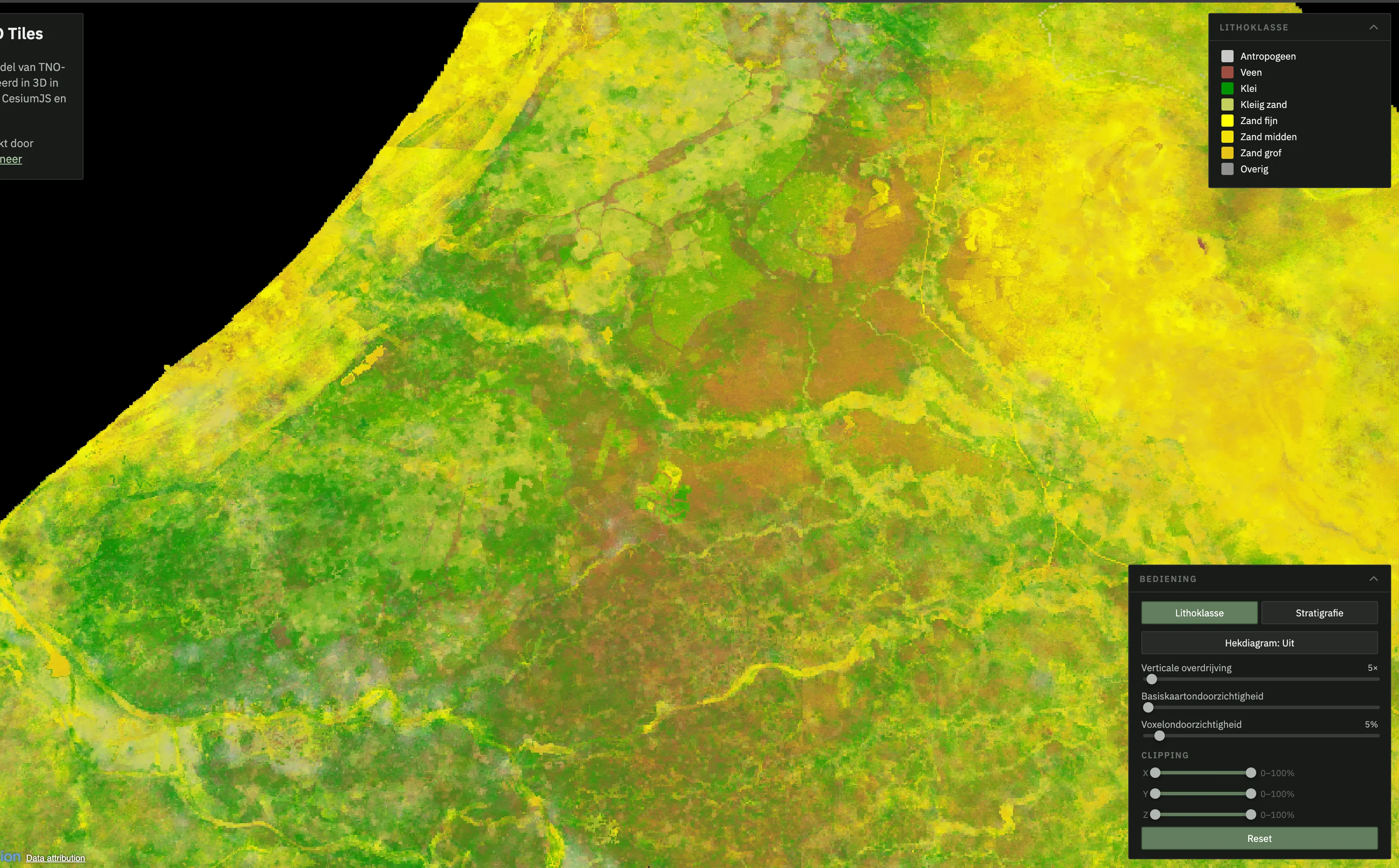
View and share your Ground Investigation data in the browser
Bridge the gap between specialized GI data formats and the wider world of geospatial tools and standards.
Explore boreholes, test results, and ground models directly in your browser, no specialist software required.
Unlock the geospatial ecosystem for subsurface data
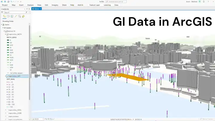
Access ground investigation data in GIS software, Python, and modern geospatial workflows.
Analyze, visualize, and automate using the tools data scientists and GIS professionals already know.
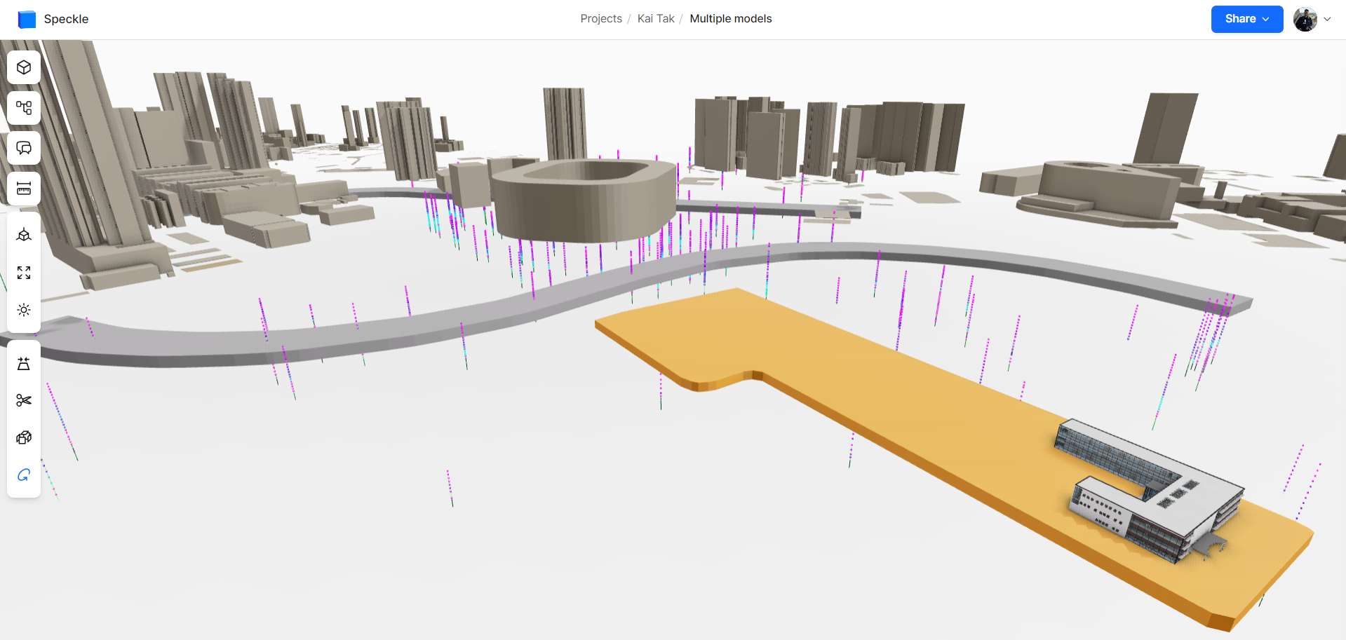
Connect subsurface data with structural and building models
Break down silos with geospatial ground investigation data. View geotechnical and structural models together in design software like Rhino3D or Civil3D. Enable seamless collaboration across disciplines using AEC collaboration platforms like Speckle,
A Software Consultancy for Subsurface Data#
We build tools and workflows that connect your ground investigation data, ground models, and analysis results to the platforms your project already runs on.
What we do:
- Convert legacy formats (AGS, GEF/CPT, gINT) into geospatial formats like GeoPackage or PostGIS databases
- Build web applications for CPT data, engineering model visualization (Plaxis, Deltares D-Series), and interactive 3D maps
- Integrate ground investigation data into digital twin platforms
- Automate workflows connecting subsurface data to QGIS, BIM tools, and databases
Our Values #
Purpose-built for subsurface data
Not generic software that "almost" fits. We've built reusable components for ground investigation data, geotechnical models, and underground assets, and adapt them to your workflows. Tailored tools without full custom-build costs.
Standard formats, any tool
Your subsurface data converted to standard geospatial formats. Use it in QGIS, ArcGIS, Python, web maps, geospatial databases. Whoever needs the data can open it in tools they already have.
Open ecosystems
We believe in open-source software and open standards to drive innovation in geotechnical engineering. We maintain bedrock-ge, our open-source Python library for turning ground investigation data into geospatial data that we use in projects.
The Team #
Jules Blom

Experienced in building data-rich geospatial applications. Specializes in making complex subsurface data clear through visualization and intuitive apps. Background in Petroleum Engineering (Reservoir Geology) at TU Delft.
Joost Gevaert

Geotechnical engineer and computational designer. Worked at Arup bridging gaps between geotechnical and structural engineering workflows. Background in Geotechnical Engineering and Applied Geophysics.