3D Tiles Voxels
Your subsurface model, explorable by anyone with the link
Your volumetric model shouldn't require a desktop application and a license to explore. We convert subsurface models into interactive, streamable 3D models in the browser using the 3D Tiles Voxel extension.
Featured by CesiumRead how we stream subsurface models with 3D Tiles VoxelsDemos #
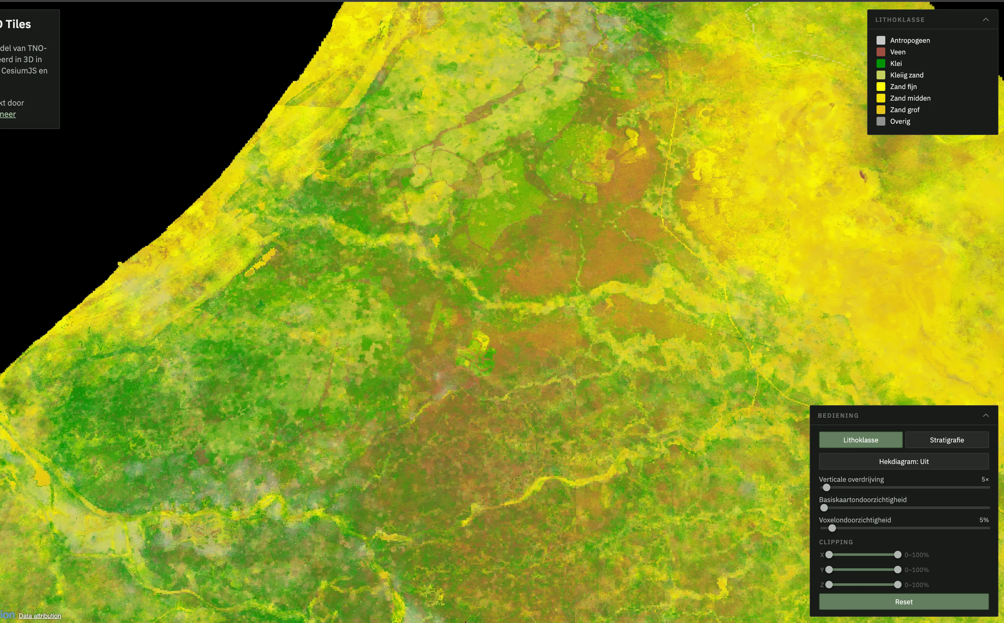
GeoTOP Voxels
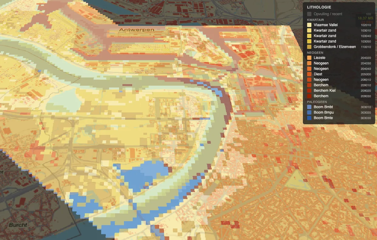
Antwerp Geological Model
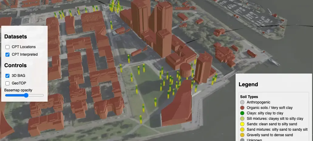
Amsterdam Noord
Built for the browser #
Stream, Don't Download
3D Tiles is optimized for viewing, only the visible voxels are streamed. A multi-million cell model loads progressively as users pan, zoom, and slice through it.
Open Standard
3D Tiles is an OGC community standardmaintained by Cesium. No vendor lock-in, your data stays in an open, documented format.
Interactive Exploration
Slice through layers, filter by property ranges, toggle between properties, all real-time in the browser. Stakeholders can explore the model themselves.
Spatial
Combine voxel models with terrain, buildings, boreholes, and infrastructure in a single scene.
What We Convert #
Your existing volumetric data, converted to 3D Tiles Voxels.
- NetCDF, Zarr Climate, ocean, and atmospheric models
- Geological voxel models Lithology, resistivity, porosity, or other property grids
- Mining block models OpenMiningFormat, GSLIB, CSV exports from Vulcan, Surpac, Datamine, Leapfrog
- Groundwater models MODFLOW structured grids
- Seismic data SEG-Y volumes
Use Cases #
- Subsurface uncertainty filter by confidence threshold, isolate zones that need more investigation
- Ore grade models visualize grade distribution across the block model. Filter by cutoff, identify high-value zones without mining software
- Stratigraphic models navigate formations in 3D instead of flipping through cross-sections. Slice at any depth or orientation
- Geotechnical properties bearing capacity, soil stiffness, derived parameters. Inspect values at any point across the site volume
- Groundwater models hydraulic head, flow paths, aquifer boundaries. Share model results with regulators and clients directly
Have a volumetric model you want to make accessible?
We convert geological block models, ore grade models, groundwater grids, seismic volumes into interactive 3D web maps. Need access controls? We can add authentication and permissions.
Contact us to discuss your data and use case.